
World Uncovered is cool
Years ago, I found an iOS app called World Uncovered. I used it for a while, then forgot about it, then started using it again. It’s pretty cool, and I keep telling people about it, so I thought I’d write a post about it.
It’s like this: you let it track your movements the same way that a fitness app like RunKeeper would, and instead of telling you how many steps you’re getting in, it tells you where you’ve ever walked, ever. Keeping in mind that I sometimes have it turned off, and forgot about it for years, check out my map for Philadelphia:
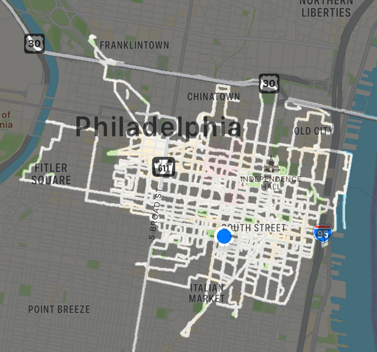
Sometimes I joke with my coworkers that I have never been to West Philadelphia. It’s not true, but… I mean, you can see my usual stomping grounds. You can also see the little excursions up toward Bethlehem, off to Camden, and down… well, I don’t know what I was doing down in South Philly, but that little diagonal below the Italian Market is definitely representative of a few trips to Milk Jawn.
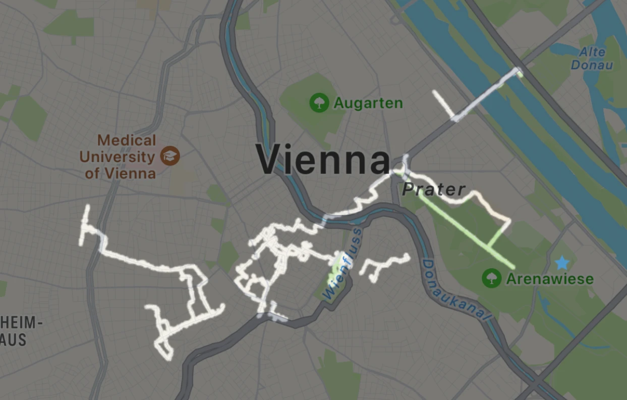
Like I said, I’d forgotten all about the app until February, when I was in Vienna for a few days. For some reason I was flipping through my phone’s screens and saw it and thought, “I should log this trip!” It was great fun, and it made me realize all the trips I had failed to log for the past few years: Norway, Brussels, England, Australia, and others. I like to see new places, and these little marked-up maps are a fun memento. Here’s Vienna:
A few months later, I was in Lisbon, which you’ll know if you’ve been keeping up with my posts here. Lisbon was fun because I took a train off to the west coast, so I got a map with two hubs of activity with a long straight train ride between them:
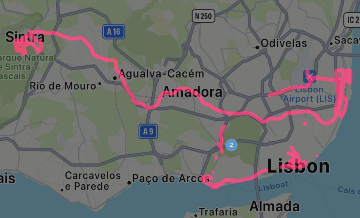
Lisbon was also where I finally got a “landmark” achievement. The app has its own (somewhat eccentric, I think) collection of landmarks, and by visiting them you can tick it off your list. If you visit enough, you get an achievement. Is this a good way to plan your travel? No. Is it fun if it happens anyway? Well, for me it was. I got Belém Tower.
Weirdly, there are no World Uncovered landmarks in Philly or in Melbourne. Still, I’ll keep an eye out for landmarks on future trips. I also wouldn’t mind getting a few of the “passport” achievements for visiting new countries. That’ll take some time, though!
As for the app itself, it feels sort of dated. It hasn’t had an updated in three or four years, and the UI is kind of clunky. The backup feature constantly needs to be reauthenticated with Dropbox, and unless you knew to turn on GPX trip mapping from day one, most of your backup will be in an encrypted zip file. So, I live in modest fear of losing all this data someday, and might look at some better way to do this. (Maybe log all my GPX data in some other app and then import it here later? I don’t know.)
I did have some email interaction with the developer recently, who told me that the app isn’t dead, just done. I can respect that, given all the software of mine that I feel is just done. I’ll keep enjoying it and not worry about its future.
Oh, and as for how I’m enjoying it, I should talk about one more thing: shorties.
Philadelphia is a grid. I like this, because it makes the city much easier for me to navigate and think about. The weird layout of Boston was sort of charming, but also kind of a total pain. I like the grid. In Center City, the grid runs from 30th Street at the west to Front Street (which is basically 1st Street) at the east. Right in the middle, Broad Street (which is basically 14th) divides the city in half. The other main north/south streets are numbered 2-29. Then the major east/west streets run from the Schuylkill River at the west to the Delaware River at the east. They’re mostly named after trees, and there are few enough that it’s pretty easy to name them all.
The thing is, there are lots of other streets in the grid. For example, between 11th and 12th is Marvine Street, running north/south. It’s not always there, though, just sometimes. It runs from Catharine north to Bainbridge, but then stops. It shows up again way further north at Race, running just one block to Vine, and then showing up again later. These streets have been dubbed “shorties” by my excellent colleague Lacey. They’re great, with lots of character and not much traffic. A hundred years ago, each length of shorty might have its own name, but they were rationalized in the 20th century. The street halfway between 8th and 9th is Darien. If it’s between 8th and 9th, but west of center, it’s Schell. If it’s east of center, it’s Mildred. Some blocks have one, two, or all three between them. (Marvine is a funny one. Between Lombard and Walnut, it’s Quince instead. I bet there’s history.)
Anyway, I would like to walk down every shorty in center city. This is not hard, it’s just going to take a lot of time, and a lot of consultation with the map. World Uncovered makes that easy. I think my next plan for tackling these is to start picking one block between home and work and on the way in, hit all of its shorties. Then another one on the way home. That will only get me about a quarter of the city, tops, but it’s a start.
The real treat is when I stop at a street that’s really rich in shorties, especially interior second-order ones, like this gem:
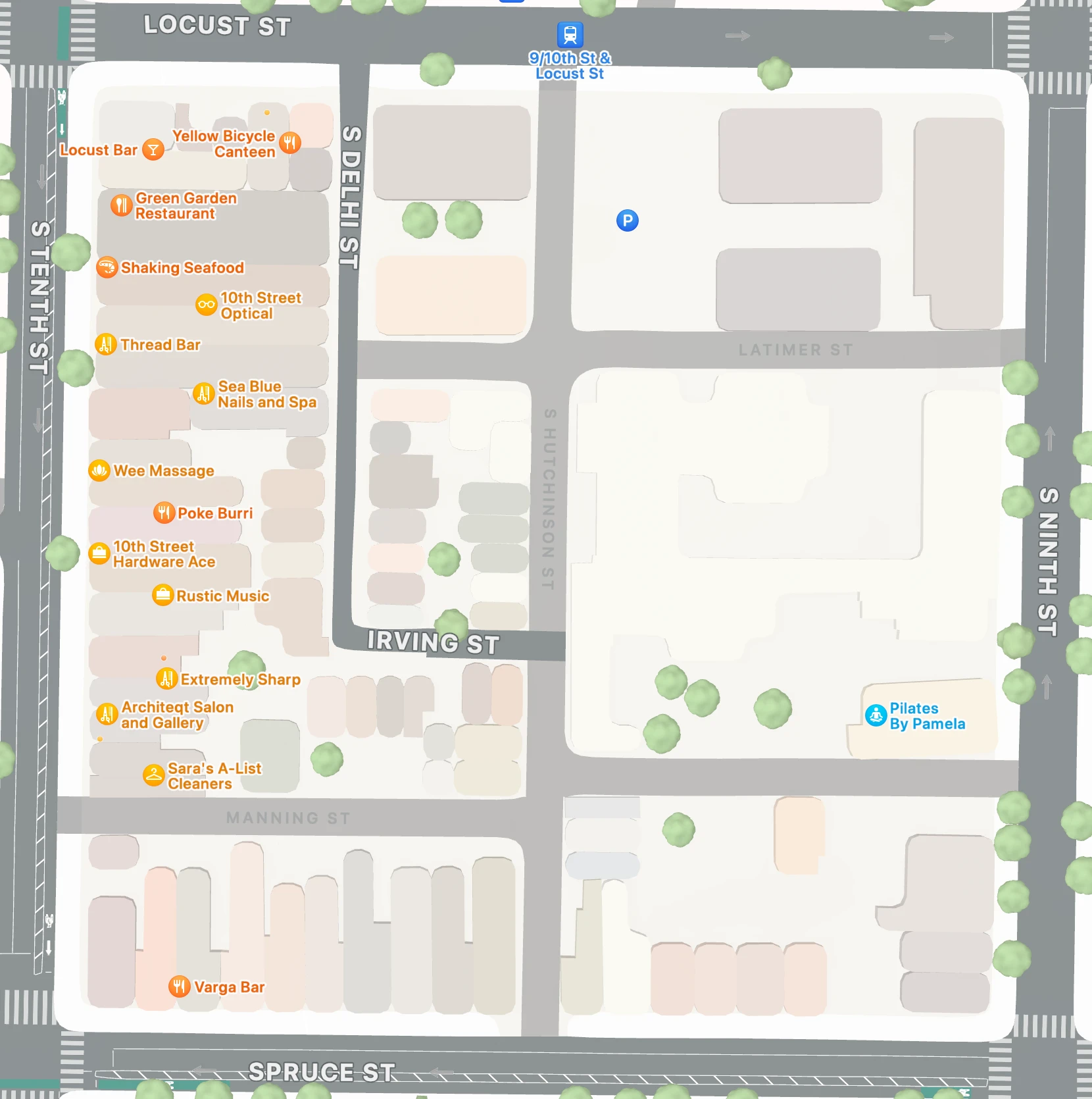
Honestly, look at that tiny length of Irving Street, which often connects two numbered streets east to west. Here, it’s a tiny little alley inside the block, only reachable by another shorty. What a city!